Turn
Information Into Action
Online interview with
Brian Holmes
Ivana Rumanová: Our area of interest in Bratislava, called Lido, is now facing a huge development project run by a bank and a real estate company. I thought it might be super interesting for us to build on your reflection on financial derivatives, flows and speculations in relation to such lands and terrains vagues such as Lido. How does it work? How do the financial markets extract value from the ground by constructing buildings on them that very often remain empty?
Brian Holmes: You’re asking all the right questions: What's this project good for? What kind of environment do we want to live in? Who is served by this development? What are its consequences on all the others?
Massive investment of public funds is central to what I’ve called megagentrification. The city makes a bet on acquiring or expanding global urban centrality. It borrows money to build infrastructure in the hopes that a large corporation will move in. The negotiations over all this are so complex that most people have no idea what is happening. Knowledge is power but actionable knowledge is rare.
Gezi Park in Istanbul showed that people will mobilize for an urban green space. What's more, the inhabitants know exactly what they are doing: resisting gentrification, inequality and climate change. A combination of knowledge, popular experience and artistic expression can make even a vacant lot into a park, and a forested spot on the river's edge is much more conducive for such transformations. It's crucial to know what is planned and what forces are behind those plans. But also, who is willing to love a different vision of the world.
In Chicago I feel the need to turn information into action. Because the most crucial information often lies dormant, producing no effects. In the context of a virtual show with the group Deep Time Chicago, I started looking at an official “toxics release” map and imagining a project in which for two months, industrial facilities with the highest risk scores would receive a letter with the publicly available information concerning their activities. The idea is to simply ask: What is your plan to ameliorate this danger? And the response, or absence of response, would be displayed publicly on the website and then hopefully in the local newspapers. This idea will probably take some time to realize, but it’s compelling. Because so many people – especially communities of color – are at risk.
IR: How about visualizing the carbon footprint of the new development projects? It is somehow surprising that this is still not an obligatory part of every new construction given the decarbonization city-plans. Is there any methodology of how to calculate and visualize it?
BH: When I looked around for an analysis of the carbon footprint of the biggest development project in Chicago, there is nothing. Yet this is an urgent issue. The project in question, called Lincoln Yards, is being built by Skidmore, Owings and Merrill, one of the largest global architecture firms. If you thought they had no understanding of ecology, you’d be completely wrong. All their city planning now includes very sophisticated environmental restructuring based on a notion of resilience that considers the viability of the project over the middle term (say, thirty to fifty years). But once again, this knowledge does not necessarily lead to any kind of democratic action, it’s just what they need to get the project built under present conditions. To obtain such knowledge as a private citizen you need to do deep research. I think the best way to produce a visualization of the carbon budget of such a development would be to go to the universities and seek out the environmental science labs or architectural studios that are actually doing it. You have to collaborate with different specialists. With Joshua Stein and Deep Time Chicago we started developing a Walkaboutit event to show the city skyline as geological stratigraphy that goes up into the air rather than down into the ground. This was based on an analysis of the extractive industries, and on the concept of sunk carbon in building materials. In parallel I began working with the CO2 budgets of Chicago buildings, which have been made public but in a kind of non-usable way. Our walk series was cancelled for the onset of the pandemic. Of course I hope to return to it.
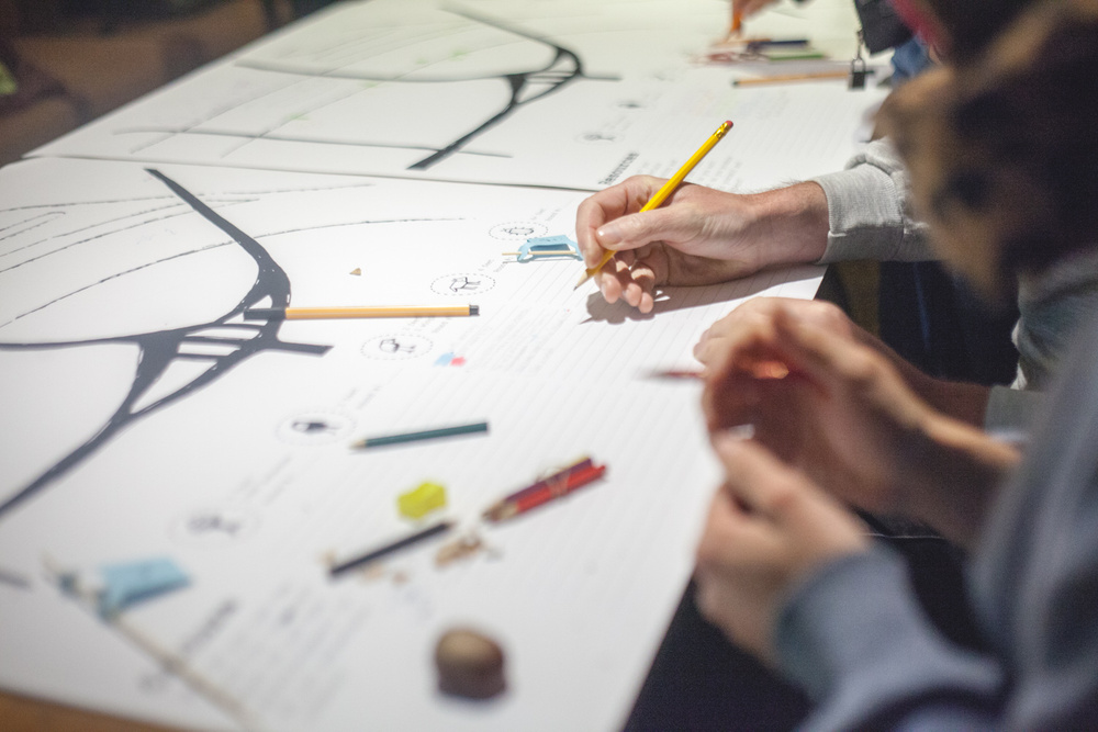
IR: You´ve been working a lot with maps and practices of mapping as one of the possible tools of how to “turn information into action”. But I´d be curious to hear more about what needs to be done so that the maps don´t exist just for their own sake, as mere representations. Who needs to see them or actualize them so that they can be mobilized as political tools?
BH: Well, I have spent a year creating some open-source mapping software, so I could say a lot about it. The real difficulty is making a map that people will actually use, and then getting that into a context of distribution. After participating in the project “Mississippi: An Anthropocene River,” a number of the artists involved are now working to maintain our network and set up a travelling show that can be unpacked at locations up and down the river. We don’t want the art to be stuck in a book or a website. Physical presence generates the best map, it’s what I like to call “cartography with your feet.”
However, as I was working on the software we got an invitation to collaborate on a gallery show that is sponsored by the most important environmental justice law firm in the US, Earth Justice. These are the lawyers who team up with oppressed people to fight pipelines and coal ash dumps and so on. My aim in making the software was to go beyond romanticism and collaborate with such groups, so when they invited us to the show, I proposed a map-based exhibition as a way to bring all our work onto their terrain of environmental justice. Already before the show has opened this has led to contacts with an important local organization, Prairie Rivers - they knew who we are, but now they see us doing work directly relevant to them, and in collaboration with Earth Justice. So this is a beginning. You can see the work at http://collectivecommunities.weinbergnewtongallery.com.
IR: Both in Mississippi: An Anthropocene River and in many other Deep Time Chicago projects there is a strong focus on proposing various formats of “experiencing” the maps and the territories to various publics. Art thus becomes a part of larger ongoing struggles, and not the final exhibited product of a grant project. I find this positioning very inspiring and crucial…
BH: Our overall project has been to make the disruption of the global biogeochemical cycles visible and understandable at metropolitan scale, with the idea that if you can see the Anthropocene and understand it, you can begin to help change it. Then we expanded that work to continental scale with the Anthropocene River project (see, among so many other things, https://mississippi.rivertoday.org). This kind of work has given us the rudiments of scientific knowledge that we need, and also the beginnings of a social network. It’s time to reach out now.
In the space that Claire Pentecost and I are opening up, called Watershed Art & Ecology, we will be building an observatory of the metropolitan region in all its scalar dimensions (intimate, territorial, urban, national, continental, global). One way to create a referential frame for this kind of activity is through cartography, because we need to have multiple pictures of the environment, connected both to multiple data-sources and inscriptions of actions, whether by social movements, artists, city officials, corporations or whatever. When I say "referential frame," I mean not only a frame for interpreting artistic gestures, although that is definitely part of it. More broadly I mean an ecological frame in which to interpret and evaluate actions on the environment. Despite many efforts I do not think a fully shareable frame like that already exists, although lots of people are working on it. Our hope is to help build up this referential frame, not only through maps, but also exhibitions, programs, collaborations.
IR: It is not always easy to communicate the value of terrains vagues to wider publics. What we do encounter very often are various aesthetic expectations that understand the “beauty” of the land in terms of its security, cleanliness, species management. How can we relate to such expectations? And also – how do you see Lido, even if only from a distance?
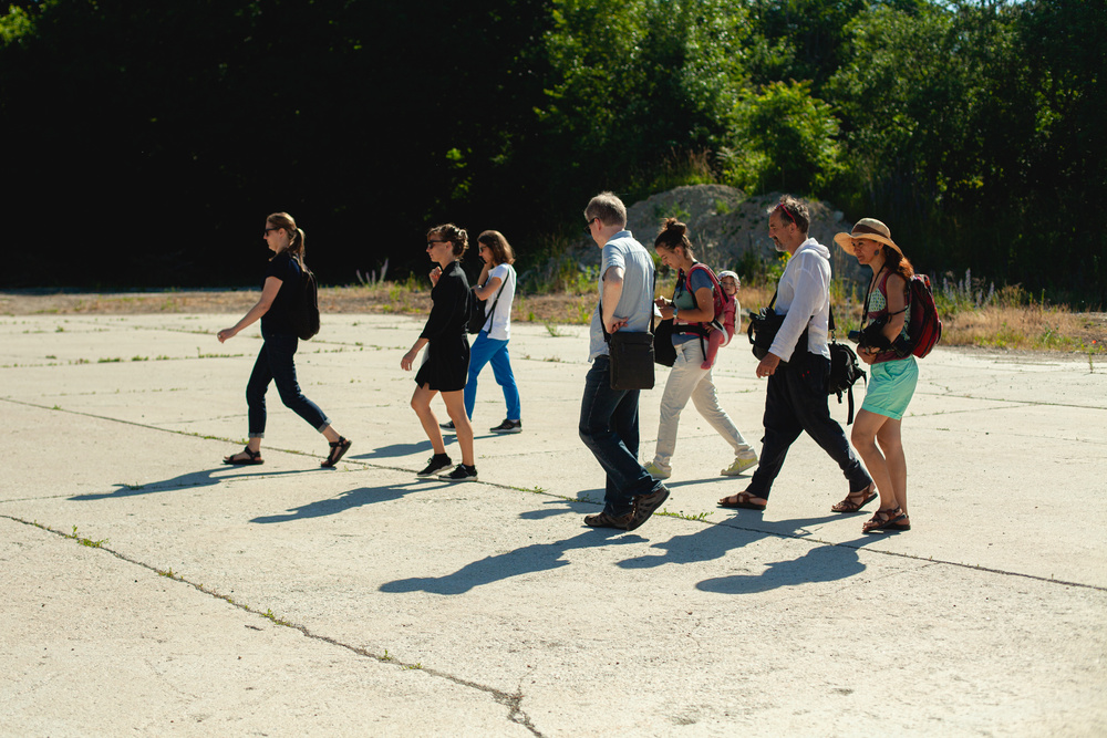
BH: It looks like a beautiful and engaging place, and the most important thing you can do is to express that to your fellow citizens. I mean, there is a kind of pleasure that everyone can recognize in the act of wandering and getting lost in a forested area along a riverbank right next to the city. It's a powerful affect. You have already been organizing public walks there, which is exactly the kind of thing we do in the Deep Time Chicago project.
The idea of such walks is that we interpret the landscape as a group. Often we have some knowledgeable person to talk about it, and we might even ask people to read a text beforehand, but it's never just a lecture outside. Instead, participants fall into different conversations as they go, you meet new people, you’re exposed to new situations, ancient histories, etc. It's not exactly an artwork, but it’s an artistic process that helps create a new form of ecological desire, while building a culture of collective perception.
IR: Creating not-only-human alliances and taking into consideration the perspective of the non-human actors at Lido is another crucial point for us. Yet, the question we ask ourselves very often is, how can we create such alliances without reducing them to merely symbolic romantic gestures?
BH: I think you avoid the romantic gesture by actually getting to know different riverine environments, and then expressing what you know. On a river like the Danube it's usually nothing romantic at all. It's a complex mixture of industrial and natural dynamics, a real mess. Now is an incredible time to get to know your local mess, and Lido is a perfect place. You could prefiguratively design or construct a public, transnational river observatory, which could be situated in the Lido area. Its vocation would be to perceive, understand and care for a river system that is channeled, dammed, polluted and in generally bad shape, like most of the environment. Yesterday if you did this, people would just ignore you. Today at least some of them won't: they are beginning to understand that Europe, too, is about to fall off an ecological cliff. The more you know about the environment, the stronger your position is. It’s really time for this kind of work!
I have had a very broad critical interest in capitalist development for many years. But the more specific way of working described above started to take form when I began exploring the Chicago river system, back when I collaborated on a project called Southwest Corridor Northwest Passage, almost a decade ago. Now one of the artists we worked with on the Anthropocene River project is helping set up protest camps against an oil pipeline that would bring Tar Sands crude to Chicago, among other places. Claire and I answered the call. At some point, this kind of work pushes you to stronger action. So I guess if you keep it up, you can really get yourself into trouble!
BRIAN HOLMES is an essayist and mapmaker who puts ecology into politics and vice-versa. After twenty years of writing and rabble-rousing in Paris and around Europe, he moved back to the United States to live in the monster city of the Midwest, where he is a member of the group Deep Time Chicago. In 2019 the group participated in the project Mississippi: An Anthropocene River, co-sponsored by the Haus der Kulturen der Welt and the Max Planck Institute for the History of Science.

What do we worship? (Beelman Terminal, Calumet River, Chicago, 2016)